Baoruco Province (Provincia de Baoruco)
 |
 |
Important features are the Sierra de Neiba mountain range and Lake Enriquillo.
The province is divided into the following municipalities (municipios) and municipal districts (distrito municipal - D.M.) within them: The following is a sortable table of the municipalities and municipal districts with population figures as of the 2014 estimate. Urban population are those living in the seats (cabeceras literally heads) of municipalities or of municipal districts. Rural population are those living in the districts (Secciones literally sections) and neighborhoods (Parajes literally places) outside them. The population figures are from the 2014 population estimate.
* Galván
* Los Ríos
* Las Clavellinas city (D.M.)
* Neiba
* El Palmar (D.M.)
* Tamayo
* Cabeza de Toro (D.M.)
Map - Baoruco Province (Provincia de Baoruco)
Map


Country - Dominican_Republic
 |
 |
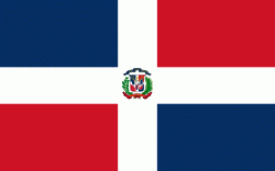
| Flag of the Dominican Republic | |
The native Taíno people had inhabited Hispaniola before the arrival of Europeans, dividing it into five chiefdoms. They had constructed an advanced farming and hunting society, and were in the process of becoming an organized civilization. The Taínos also inhabited Cuba, Jamaica, Puerto Rico, and the Bahamas. The Genoese mariner Christopher Columbus explored and claimed the island for Castile, landing there on his first voyage in 1492. The colony of Santo Domingo became the site of the first permanent European settlement in the Americas and the first seat of Spanish colonial rule in the New World. It would also become the site to introduce importations of enslaved Africans to the Americas. In 1697, Spain recognized French dominion over the western third of the island, which became the independent state of Haiti in 1804.
Currency / Language
| ISO | Currency | Symbol | Significant figures |
|---|---|---|---|
| DOP | Dominican peso | $ | 2 |
| ISO | Language |
|---|---|
| ES | Spanish language |
